
S580+ GNSS Receiver
GNSS Receiver for GIS & RTK Applications
S580+ GNSS Receiver
GNSS Receiver for GIS & RTK Applications
S580+ is a compact and light GNSS receiver but at the same time performing and with centimeter accuracy.
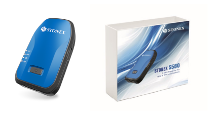
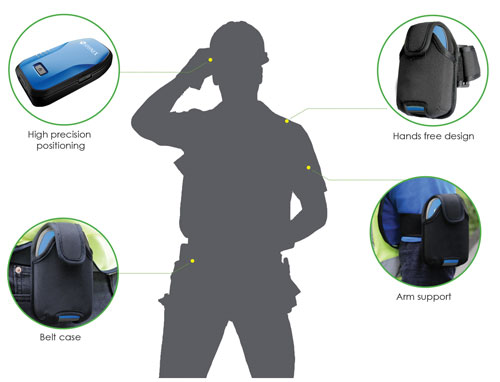
The S580+ is a compact and lightweight GNSS receiver with exceptional performance and centimeter precision, thanks to the GNSS board with 1408 channels. The S580+ works with GPS, GLONASS, BeiDou, Galileo, and QZSS satellite systems and it is equipped with IMU technology that supports inclined measurements. Compared to traditional GIS products, the S580+ is a high-precision, intelligent data acquisition receiver that can be worn or attached to a pole, offering greater freedom of movement and flexibility.
The S580+ can communicate with an external device such as a tablet, smartphone, or PC via Bluetooth and Wi-Fi. The receiver can be configured via the internal web interface or the Cube-connector app to receive RTK differential corrections and connect seamlessly to survey or GIS third-party software. The rubber protective cover increases device protection, is non-slip and non-damaging; the overall device protection reaches IP67 and withstands drops from 1.2 meters on hard surfaces.
IMUs are sensors that utilize a combination of accelerometers, gyroscopes, and magnetometers to accurately track movement and orientation. These advanced sensors offer a valuable solution for surveying in difficult or inaccessible locations where traditional methods may not be practical.
S580+ DATA SHEET
S580+ BROCHURE
Price: Call for Pricing!
Questions? Contact Tyler Bristow | 757.647.7016 | tyler@centerlinemapping.com
The S580+ is a compact and lightweight GNSS receiver with exceptional performance and centimeter precision, thanks to the GNSS board with 1408 channels. The S580+ works with GPS, GLONASS, BeiDou, Galileo, and QZSS satellite systems and it is equipped with IMU technology that supports inclined measurements. Compared to traditional GIS products, the S580+ is a high-precision, intelligent data acquisition receiver that can be worn or attached to a pole, offering greater freedom of movement and flexibility.
The S580+ can communicate with an external device such as a tablet, smartphone, or PC via Bluetooth and Wi-Fi. The receiver can be configured via the internal web interface or the Cube-connector app to receive RTK differential corrections and connect seamlessly to survey or GIS third-party software. The rubber protective cover increases device protection, is non-slip and non-damaging; the overall device protection reaches IP67 and withstands drops from 1.2 meters on hard surfaces.
IMUs are sensors that utilize a combination of accelerometers, gyroscopes, and magnetometers to accurately track movement and orientation. These advanced sensors offer a valuable solution for surveying in difficult or inaccessible locations where traditional methods may not be practical.
S580+ DATA SHEET
Price: Call for Pricing!
Questions? Contact Tyler Bristow | 757.647.7016 | tyler@centerlinemapping.com
