Software for Mapping and Surveying


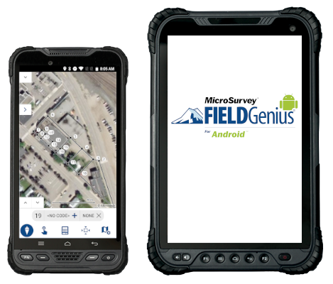
FieldGenius for Android
Field Software Solutions

FieldGenius for Android provides a brand-neutral solution, supporting most common hardware available in the market today.

FieldGenius provides advanced features such as tilt compensation, RTK corrections, GIS attribute collection, COGO, shapefile import/export, and more.

DATA SHEET

Price:   Call or Email for a Quote!
Questions? Contact Tyler Bristow | 757.647.7016 | tyler@centerlinemapping.com

Features

  • Work with Android Tablets and phones.

  • Measure points in the field.

  • Conduct COGO calculations, see the results immediately on the map, and save the results using project points.

  • Create line work on the go while collecting points.

  • Easily assign codes to points.

  • Improved editing of line segments in the field.

  • Updated point staking workflows and navigation displays.

  • Display of satellite maps and images as background files in the map view screen.

  • Ability to login to WMS servers for background maps.

  • Access to the MicroSurvey library of coordinate systems, geoids, and grid shift files as well as the ability to define a custom coordinate system.

  • Support for a wide number of GNSS receivers from major Original Equipment Manufacturers.

  • Rapid deployment of new features and bug fixes.

  • Tilt Measurement Support.

  • Shapefile Import/Export to support working with GIS software.

  • GIS Attribute Collection – allowing users to tag attribute information with their observations.

  • Surface staking.

  • GNSS Offset functionality.


Contact Us!


Have a question about something? Get in touch!

Email us: tyler@centerlinemapping.com
Give us a call: 757-647-7016